
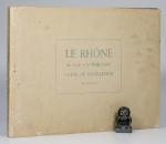
La Saone / Le Rhone.
Two Volumes. Lyon, Rene Salagnac, 1958 & 1960. 29 x 20 cm (oblong). 21 and 15 folding Plates. Original stiff cardboard covers. Stapled. Very good condition.
EUR 70,-- Order
The catalog contains 49 items. Drop search results and show the complete catalog.
Order by: Author · Title · Keyword · Year · Price (up) · Price (down) · Inventory Number · Recent Changes · Relevance
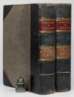
The Imperial Gazetteer of Scotland; or Dictionary of Scottish Topography. Compiled from the most recent Authorities. And forming a complete Body of Scottish Geography. Physical, Statistical, and Historical. Illustrated with a complete County Atlas, various chorographical Maps, Plans of Ports, Harbours, and interesting Views.
Two Volumes – Complete. London and Edinburgh, A. Fullarton & Co., ND (c. 1860). 25 x 16.5 cm. Vol.1: lxviii, 816 pages / Vol.2: 872 pages. Both volumes with coloured maps, and B&W plates. Volume 1 with a large folding map of Scotland (repaired in the back). Contemporary half calf over cloth covered boards. Marbled edges. Gilt and blind decorations. Spine labels. Very good condition. Binding rubbed and bumped. Edges and end papers dust dulled. folding map with long closed tear, which has been repaired in the back. Internally bright and clean. A very nice copy with interesting Maps and Plates. See images.
EUR 260,-- Order
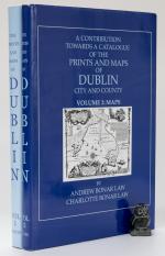
A Contribution towards a Catalogue of the Prints and Maps of Dublin City and County. Volume 1: Prints. Volume 2: Maps.
First and Limited Edition of 500. Set 97. Shankill Castle, Co. Dublin, The Neptune, 2005. 29 x 21 cm. Vol.1: x, (2), 248, (10) [Index] / Vol.2: ii, pages 251 – 411, (10). Illustrated throughout. Original dark blue cloth. Gilt titles. Inside original decorated dust jackets, now inside clear archival jackets. Near fine books inside very good dust jackets. Volume 1 inscribed and signed by the Author. Very clean copies. Dust jackets with minor edge wear. Overall a very nice set.
EUR 300,-- Order
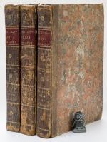
Encyclopaedia Britannica. Three Plates Volumes with 460 Plates. Volumes 1, 3 & 4 (including the Plates issued as a Supplement in 1801-03.
Third Edition & Supplement to 3rd Edition. Three volumes of four. [Edinburgh], [Privately published by Andrew Bell, Archibald Constable & Colin Macfarquhar], [1788 – 1803]. c. 26 x 20 cm. Vol.1: Plates 1 – 161 / Vol. 3: Plates 292 – 446 / Vol. 4: Plates 447 – 542 and 1 – 50. See comments below for noted ‘anomalies’. Contemporary half calf over marbled boards. Red spine labels with gilt title. Gilt decorations and volume numbers in gilt. Very good condition. Bindings rubbed and bumped with wear to spine and ends and corners (see images). Edges age darkened. Joints cracked, but bindings remain sound. Spine leather dried and cracked. Internally dust dulled, but generally clean. A few closed tears and some edge wear to some plates. Overall a very nice collection of more than 450 plates. See images.
EUR 1.500,-- Order
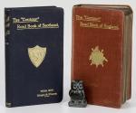
The Contour’ Road Book of England / Scotland. A Series of Elevation Plans of the Roads with Measurements and Descriptive Letterpress.
Two Volumes. London / Edinburgh, Gall & Inglis, 1913 / 1923. 15 x 9 cm. England: 848 pages plus Index and folding map / Scotland: 288 pages plus Index. Original cloth bindings with gilt titles and decorations. Very good condition. See images.
EUR 45,-- Order
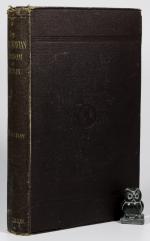
The Scandinavian Kingdom of Dublin.
First Edition. Dublin, Alex. Thom & Co, 1881. c. 24.5 x 15.5 cm. cxxiii, 300 pages. Complete with seven folding maps / plates, as listed. Contemporary textured brown cloth. Blind decorations and gilt title on spine. Very good condition. Some shelf wear, rubbing and bumping. Spine ends frayed. Front free end paper missing. Binding weak, but holding. Mild foxing to first and last few pages. All maps in excellent condition.
EUR 250,-- Order
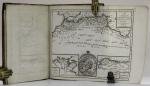
Atlas de l’ancienne Géographie Universelle comparée à la Moderne. Precede D’Une Table General, en Forme de Dictionnaire, de tous les noms anciens des Royaumes, Provinces, Villes, Fleuves, Rivieres, Lacs, Montagnes, etc., qui se trouvent dans l’Ancienne Geographie universelle.
A Paris, Andre Augustin Lottin / Arthus Bertrand, An IX. (1801). 29 x 22 cm. Title page, TOC, 78 pages, (2). Complete with 18 Maps, as listed. Order: 1-11, 15, 16, 17, 18, 12, 13, 14. Most Maps folding. Contemporary half calf over marbled boards. Very good condition. Minor shelf wear, rubbing and bumping. Edges and end papers dust dulled. Small paper sticker with name of previous owner on title page and one more location. All Maps in very good condition, with some showing some creasing and edge wear. Map 10 (Grece) with closed tear of c. 6 cm. Overall a very good copy.
EUR 320,-- Order
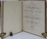
Smith’s Classical Atlas & New General Atlas (two Atlases bound into one). Full Titles: 1. Smith’s Classical Atlas Containing Distinct Maps of the Countries described in Ancient History both Sacred and Profane / 2. Smith’s New General Atlas Containing Distinct Maps of all the Principal Empires, Kingdoms, & States Throughout the World. Arranged According to the General Treaty signed in Congress at Vienna, June 1815.
London, Printed for C. Smith, Mapseller extraordinary to his Majesty, 1820 & 1822. c. 40 x 32 cm. Classical Atlas: Engraved title page, TOC, 14 Maps, incl. eight double paged / 2. Engraved title page, TOC, 49 Maps, incl. 7 doubled paged. Complete with all maps, as listed in the TOCs. Contemporary half leather over marbled paper boards. Rebacked in 2024 using the original boards and spine. New end papers. Very good condition. Binding rubbed and bumped with minor material losses to spine ends and corners. Ages age darkened. Internally clean with mild dust dulling and occasional very mild foxing. Some neat annotations to some maps, mainly Britain and Europe. Overall a very nice copy of two atlases, published in 1820 and 1822, bound into one.
EUR 2.000,-- Order
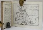
Geographia Antiqua. Smalcaldensis Geographia antiqua. Recognita denuo, & ad veterum novorumque scriptorum fidem, historiocorum maxime idemtidem castigata & Quinta editione plurimis locis aucta et immutata.
London, S. Ballard, J. Senex, G. Innys, J. Osborn, & T. Longman, 1731. c. 20 x 12 cm. viii, 180 pages. 26 (of 27) Maps, lacking map of ‘Acarnania, Graecia Propria & Peleponnesus. Contemporary calf. Raised bands. Red speckled edges. Very good condition. No free end papers. Binding rubbed and bumped. Hinges tender. Lacking one map. Otherwise a very nice clean copy. See images.
EUR 240,-- Order