
The Burren. A two-inch map of the uplands of north-west Clare.
Roundstone, Co. Galway, Folding Landscapes, Map printed by the Print Consortium of Ireland, 1999. 104 x 73 (unfolded). Map inside small plastic sleeve. As new.
EUR 75,-- Order
The catalog contains 47 items. Drop search results and show the complete catalog.
Order by: Author · Title · Keyword · Year · Price (up) · Price (down) · Inventory Number · Recent Changes · Relevance
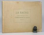
La Saone de Lyon A Corre. (Jonction au Canal de l’Est). Carte Pour La Navigation. Echelle: 1/20000 e.
2nd Edition. Lyon, Rene Salagnac, 1958. 20 x 29 cm (oblong). 21 Folding Plates (Feuillet). Original stiff cardboard covers. Stapled. Title on front board and spine. Very good condition. Minor shelf wear and dust dulling. Internally bright and clean.
EUR 40,-- Order
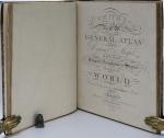
Smith’s Classical Atlas & New General Atlas (two Atlases bound into one). Full Titles: 1. Smith’s Classical Atlas Containing Distinct Maps of the Countries described in Ancient History both Sacred and Profane / 2. Smith’s New General Atlas Containing Distinct Maps of all the Principal Empires, Kingdoms, & States Throughout the World. Arranged According to the General Treaty signed in Congress at Vienna, June 1815.
London, Printed for C. Smith, Mapseller extraordinary to his Majesty, 1820 & 1822. c. 40 x 32 cm. Classical Atlas: Engraved title page, TOC, 14 Maps, incl. eight double paged / 2. Engraved title page, TOC, 49 Maps, incl. 7 doubled paged. Complete with all maps, as listed in the TOCs. Contemporary half leather over marbled paper boards. Rebacked in 2024 using the original boards and spine. New end papers. Very good condition. Binding rubbed and bumped with minor material losses to spine ends and corners. Ages age darkened. Internally clean with mild dust dulling and occasional very mild foxing. Some neat annotations to some maps, mainly Britain and Europe. Overall a very nice copy of two atlases, published in 1820 and 1822, bound into one.
EUR 2.000,-- Order
Map No. 2 of the Lough Neagh District. Surveyed by order of the Commissioners for Improving Bogs in Ireland. [Plate XIX. No. 2 – Third Report of the Commissioners on the Nature and Extent of the Bogs in Ireland.
[London], Ordered by the House of Commons to be Printed, 1814. 64 x 52 cm. Single page – folded. Unbound. Very good condition. Minor shelf wear and age darkening. Scarce.
EUR 150,-- Order
Map No. 3 of the Lough Neagh District. Surveyed by order of the Commisioners for Improving Bogs in Ireland. Plate XX. No. 3. Third Report mof the Commisioners on the Nature and Extent of the Bogs in Ireland.
[London], House of Commons, 1814. c. 66 x 56 cm. Single sheet map. Folded. Unbound. Very good condition. Minor edgewear and age darkening.
EUR 150,-- Order
Map No. 4 of the Lough Neagh District. Surveyed by order of the Commisioners for improving Bogs in Ireland. Plate XXI. No. 4. Third Report of the Commisioners on the Nature and Extent of the Bogs of Ireland.
[London], House of Commons, 1814. c. 68 x 56 cm. Single page map – folded. Unbound. Very good condition. Minor edgewear and age darkening.
EUR 150,-- Order
Map No. 6 of the Lough Neagh District. Surveyed by order of the Commissioners for Improving Bogs in Ireland. [Plate XXIII. No. 6 – Third Report of the Commissioners on the Nature and Extent of the Bogs in Ireland.
[London], House of Commons, 1814. c. 54 x 44 cm. Single sheet map – folded. Unbound. Very good condition. Minor edge wear and age darkening.
EUR 150,-- Order
Map No. 7 of the Lough Neagh District. Surveyed by order of the Commissioners for Improving Bogs in Ireland. [Plate XXIV. No. 7 – Third Report of the Commissioners on the Nature and Extent of the Bogs in Ireland.
[London], House of Commons, 1814. c. 59 x 50 cm. Single sheet map – folded. Unbound. Very good condition. Minor edge wear and age darkening.
EUR 150,-- Order
Map of the Southern Part of District No. 8. Surveyed by order of the Commissioners for Improving Bogs in Ireland. [Plate 5 – Third Report of the Commissioners on the Nature and Extent of the Bogs in Ireland.
[London], House of Commons, 1814. c. 57 x 54 cm. Single sheet map – folded. Unbound. Very good condition. Minor edgewear and age darkening.
EUR 150,-- Order